A Professional Land Surveyor is a person who has qualified by education and experience, and who has passed an examination for registration required by the State of Arizona to practice Land Surveying in Arizona.
When might I need a Survey?

Which type of survey do I need?
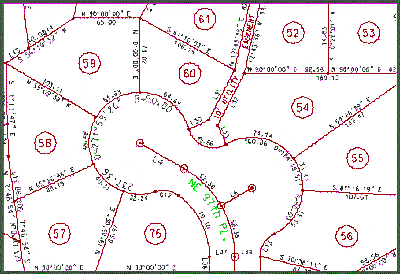
There are five basic types of surveys.Please note that the plats on file with the County ASSESSORS Office do not constitute a survey. A recorded subdivision plat or Record of Survey will be recorded with the County RECORDER. Assessors maps are for tax purposes only and lack the information necessary to perform a survey.
A corner restoration survey would be one where an adequate record plat
exists of the parcel to be surveyed. This would include most residential
lots within cities. As long as there are no material discrepancies found
between the record plat and the results of the survey, no new plat would
be necessary. Should there be discrepancies between record information
and the results of survey, or if there is no plat of record ( as would
be the case in creating a new parcel), the surveyor must prepare a plat
within the guidelines required for Arizona Land Boundary Surveys. This
mapping will usually add to the cost of the survey. The Arizona Land Boundary
Survey plat would be suitable for recording and will provide future surveyors
with all data necessary to re-create the boundaries of the parcel. 
Some mortgage institutions will require an A.L.T.A. lenders policy prior to close of escrow. This type of survey is probably the most involved of all boundary surveys. The surveyor must communicate closely with the lender and the Title insurer to determine the extent and requirements of the survey. If you have been required to provide an A.L.T.A. survey, please visit the ACSM / American Land Title Association (A.L.T.A.) site. The requirements of an A.L.T.A. survey may cause the cost to vary dramatically.
It should be noted that the Arizona State Board of Technical Registration dictates an accuracy requirement for all surveys performed in Arizona. The cost of the survey does not relieve the surveyor from providing a reliable survey. Whether you require a corner restoration or an A.L.T.A. survey, the same technical knowledge, skill and care must be employed in the performance of each survey. Arizona has four classes of boundary surveys. They are:
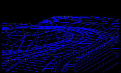
An engineering surveys accumulates data for your engineer or architect
to design from. This may include contour maps, "as-built" mapping, volumetric
surveys or aerial photogrammetry. Your engineer will advise you as to his
needs.
 Surveyors
are instrumental in construction and development. They provide the lines,
grades and elevations for the proper completion of your project. Your engineer
or architect will provide you with design plans. It will then be necessary
to employ a surveyor to provide the stakes necessary for your construction
crew to follow the plans.
How much will a Survey cost?
Fees of Surveyors are on a level with other professions. The Surveyor's fees are not dependent upon the size of the tract . Other factors, including complexity of the legal description, the terrain and vegetation, accessibility, and if reliable survey monuments exist in the area may greatly affect the cost of a survey. Therefore, the Surveyor will estimate the approximate cost of the survey for you prior to commencing the work. However, do not depend on the lowest priced survey to be the best survey. Obtain the services of a reputable Surveyor.
What can a Surveyor do for me?
What does the Surveyor need from me?
The more information you can furnish the Surveyor, the more you may expedite the Surveyor's work. However be sure the information you provide is reliable. The property description provided on your property tax statement is not always a reliable source.Such information includes:
What should I receive from the Professional Land Surveyor?
How can I obtain the services of a licensed Land Surveyor?
What if I have a complaint about a Surveyor's work?
1 .Consult with the Surveyor and try to reach an agreement..
2. If you still have a problem, contact the Arizona State Board of
Technical Registration. A.S.B T.R. maintains vigilance over Surveyor's
actions through its Code Enforcement Committee. All registrants are subject
to a CODE OF PROFESSIONAL CONDUCT,
which dictates a complete and high standard of work. If you feel you have
a legitimate complaint, please contact the Code Enforcement Committee in
Phoenix at 1951 West Camelback Rd., Suite 250, Phoenix AZ., 85015, or phone
them at (602) 255-3737.